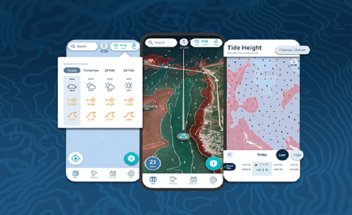
How do Marine navigation Apps Balance Offline and Online Functionality?

Marine navigation apps have revolutionized the way sailors and boaters navigate on the water. Whether you’re planning a weekend getaway or a long voyage, having a reliable navigation tool is essential. But how do these apps manage to strike a balance between offline and online functionality, ensuring you’re covered no matter where your journey takes you? Understanding this balance can help you choose the best marine navigation app for your needs.
The Importance of Online and Offline Features
Reliable navigation is key to any boating trip, but internet connectivity isn’t always guaranteed. Marine navigation apps solve this issue by offering both online and offline functionalities, allowing users to navigate confidently regardless of network availability. This dual-mode approach ensures that boaters have access to the most important data at all times.
Online Features: Real-Time Updates and Connectivity
1. Live Weather Updates
When connected to the internet, marine navigation apps can provide real-time weather updates. These include forecasts for wind speed, wave height, and potential storms, which are crucial for planning safe routes. With access to live weather data, boaters can adjust their journeys based on current conditions, ensuring a safer voyage.
2. AIS (Automatic Identification System)
The Automatic Identification System (AIS) is an online feature that allows boaters to track nearby vessels in real time. AIS data is particularly useful in crowded waters or during low-visibility conditions, helping to avoid collisions by showing the location of other boats. Some apps offer basic AIS functionality offline, but the most accurate, up-to-date data requires an internet connection.
3. Tide and Current Information
Marine navigation apps also provide real-time updates on tides and currents, which are essential for navigating through channels or docking. These updates can help boaters make timely decisions when approaching shallow waters or harbours. Many apps allow users to download tide and current information in advance, making it accessible offline.
4. Community-Sourced Updates
Many apps feature crowd-sourced information, allowing users to share real-time updates on hazards, points of interest, and safe routes. These updates are only available when online but offer valuable, up-to-date insights into navigational risks or local attractions. Users can also share their location with others in real time, enhancing the social and safety aspects of navigation.
Offline Features: Navigating Without Internet Connectivity
1. Offline Maps and Charts
One of the most critical offline features of marine navigation apps is the ability to download maps and charts for use without an internet connection. Boaters can store detailed charts on their devices, which include coastlines, depth contours, and navigational markers, ensuring they have the data they need even in remote areas. For example, the best marine navigation app will allow you to download charts for specific regions before your journey.
2. GPS Tracking
Most marine navigation apps use your device’s GPS to track your position, even without an internet connection. This offline GPS functionality allows boaters to follow pre-planned routes, ensuring they stay on course. GPS tracking is a critical feature for offshore navigation, where connectivity may be limited or non-existent.
3. Pre-Downloaded Weather and Tide Data
Although live weather updates require an internet connection, many apps allow users to download weather forecasts and tide information in advance. This means boaters can still access important data during their trip, even without connectivity. Some apps automatically refresh this data when an internet connection is available, ensuring that users have up-to-date information stored for offline use.
4. Routing and Waypoints
Most marine navigation apps offer offline routing capabilities, allowing boaters to plan and follow routes based on pre-downloaded maps and charts. Users can set waypoints, follow saved routes, and navigate safely, even in areas without network coverage. This offline routing feature is essential for those exploring remote areas or crossing large bodies of water.
Choosing the Right Marine Navigation App
When selecting the best marine navigation app, it’s important to consider how well it balances online and offline features. Boaters who frequent remote areas should prioritize apps with strong offline functionality, such as downloadable maps and GPS tracking. On the other hand, those who stay closer to shore might find more value in online features like AIS and real-time weather updates.
In conclusion, marine navigation apps offer a comprehensive blend of online and offline features that ensure reliable navigation under any conditions. With live updates when connected and essential offline capabilities when internet access is unavailable, these apps are indispensable tools for boaters of all experience levels, helping them stay safe and on course throughout their voyages.


